Day 108 Basel to Sissach
The sky looked rather threatening as we set out this morning. In fact the sky dropped a dollop or two of water onto our unprotected heads as we strolled past some impressive banking premises. We pretended that nothing was happening and chuckled at this feeble attempt at putting us off our intention of going for a stroll. After a minute or two it looked as though rainwear was once more the order of the day so we struggled into our coats and pressed on towards the Rhine and our path.

We wondered how we would manage with our new map, hoping that it would have enough detail for our needs. We have become accustomed to a 1:25000 scale and now we were to be using a 1:60000 so this was another potential source of banana skins. In theory the start of the stroll should have been easy as it followed the Rhine for a few miles. The Rhine is not easy to miss so we thought we would get the hang of things before needing to be clever.

Initially our stroll took us along a long boulevard and under some trees. It was under the trees that the rain really decided to show us what it could do if it tried. We saw a bloke just in swimming trunks walking along and disappearing into a house. I don’t know if he had been for a swim or was making a statement against the weather. The river side became more and more industrial as we left the pretty bits of Basel behind.

The footpaths, wanderwegs, are really well marked and we had no difficulty following them. We both agreed that today was the best way marking we have seen since we had strolled down Offa’s Dyke to Knighton. The only blemish on this otherwise perfect score was around the industrial area. We found ourselves way off beam and without satnav would have been in a pickle. The change of direction was marked and pointed over a narrow railway bridge, but in a place which was not clearly visible from the path at that point. If we hadn’t made the mistake then we would have missed seeing the huge and fabulous metal sculpture outside a welding factory, so we weren’t really fed up.

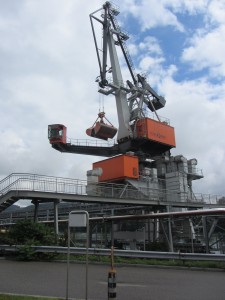
Once back on the right track we made really good progress. The path then took us on a bridge past a great monster of a mechanical shovel
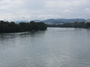
The Rhine continues on with a few hills to prepare us for what is to come.
More hills, this time we are a bit higher.

We have been strolling on the flat for a long time now and it took us a few miles to get used to going up and down.

More up tiddly up up.
As we approached Altmark the map showed us, very clearly, that we needed to stay on a particular side of the railway line but the waymarks told us to go over the railway line. Instead of following the waymarkings, reading the map or looking at the satnav we steadfastly stayed on the ‘correct’ side of the railway line. After about fifteen minutes of this I smelled a distinct odour of fish. My satnav suggested that we were in a field and leaving the railway line at right angles and at a great speed. We were in a new housing estate which explained the empty field bit but not the right angles to the railway line bit.
We have noticed that trams are a popular means of mass transport here in Switzerland. We hadn’t realised that trams go out of town and into the countryside. We had been following a perishing tram line not the railway line. About turn and a smartish retreat to our original position was the only option. We resolved to follow the signs from now on, no matter how outlandish they appear to be, well at least until the next time anyway.

Finally, Sissach was in our sights. No more up for today. We had measured the day’s stroll to about 15 miles. In the end I think that it was about 19 miles but it really was fabulous to be in the hills again. It looks as though the stroll to Luzern won’t be too high and it will prepare us for the Luzern to Lugano section, which will be high.

On the way into Sissach we spotted a bird on a fence post. It looked like some sort of predatory bird although it seemed fairly relaxed on its perch.
It looks as though the 1:60000 maps will be fine, as long as the waymarking stays as good as today has been. The only problem really is that we can’t estimate distance travelled along the map very easily yet. If it weren’t for the satnav we would have made a few blunders just because of the map scale. We’ll test the map again tomorrow on another stroll in Switzerland
Interesting to read about the section Mulhouse to Basel – brought back memories of May when we also had a problem finding our way around a certain boatyard – we were cyclists travelling over 20 kph but naturally ever polite to pedestrians. We’d be really interested to see you this week. We’re only 15 km from Luzern and would be delighted to put you up & hear about your stroll. We can offer a Swiss experience or alternatively a British one if you are craving marmite, branston pickle or decent tea. You could divert to our village – Buonas (a mere dot on the map near Rotkreuz) before hitting Luzern. If you’d rather stay in Luzern we could get together for a meal one night this week. As I think I mentioned we’re leaving on Friday afternoon to cycle Geneva to the Spanish Pyrennes.